
Select NOAA-NWS Forecast Office Text Products |
Today's Weather Story 48 Hour Graphical Forecast |
(Product availability varies with seasons, forecast office, and weather.)
Hazardous Weather Outlook for Denver/Boulder, CO
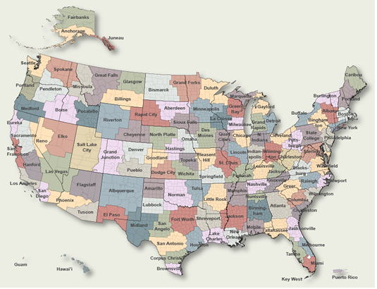
To Select Another NWS Office Click on Map or Choose from List
|
| Select Forecast Office: | Select Product: |
000 FLUS45 KBOU 270832 HWOBOU Hazardous Weather Outlook National Weather Service Denver/Boulder CO 232 AM MDT Sat Apr 27 2024 COZ030>051-280845- Jackson County Below 9000 Feet- West Jackson and West Grand Counties Above 9000 Feet- Grand and Summit Counties Below 9000 Feet- South and East Jackson/Larimer/North and Northeast Grand/ Northwest Boulder Counties Above 9000 Feet- South and Southeast Grand/West Central and Southwest Boulder/ Gilpin/Clear Creek/Summit/North and West Park Counties Above 9000 Feet-Larimer and Boulder Counties Between 6000 and 9000 Feet- Jefferson and West Douglas Counties Above 6000 Feet/Gilpin/Clear Creek/Northeast Park Counties Below 9000 Feet- Central and Southeast Park County- Larimer County Below 6000 Feet/Northwest Weld County- Boulder And Jefferson Counties Below 6000 Feet/West Broomfield County- North Douglas County Below 6000 Feet/Denver/West Adams and Arapahoe Counties/East Broomfield County- Elbert/Central and East Douglas Counties Above 6000 Feet- Northeast Weld County-Central and South Weld County-Morgan County- Central and East Adams and Arapahoe Counties- North and Northeast Elbert County Below 6000 Feet/North Lincoln County- Southeast Elbert County Below 6000 Feet/South Lincoln County- Logan County-Washington County-Sedgwick County-Phillips County- 232 AM MDT Sat Apr 27 2024 ...HEAVY SNOW FOR THE FRONT RANGE MOUNTAINS AND HIGHER FOOTHILLS... This hazardous weather outlook is for northeast and north central Colorado. .DAY ONE...Today and Tonight A strong spring storm system will move across Colorado today bringing widespread rain and snow to the mountains, foothills and Palmer Divide. The snow level will lower to around 6500 feet. Travel into the higher foothills and mountains will likely be very difficult with 1 to 3 feet of snow expected, with 4 to 12 inches over South Park and Palmer Divide. One or two strong storms may develop over Lincoln County this afternoon. Hail up to quarter size would be the main threat. .DAYS TWO THROUGH SEVEN...Sunday through Friday Rain is expected to linger into Sunday morning over far northeast Colorado, other most of the Front Range and eastern plains will be dry to start Sunday. Mountain snow showers will prevail Sunday with a few inches possible. .SPOTTER INFORMATION STATEMENT... Spotter activation will not be needed today or tonight though rainfall, snowfall will be appreciated. $$ |
Previous Hazardous Weather Outlooks may be found at
NWS Denver/Boulder, CO (BOU) Office Hazardous Weather Outlooks.
(Click 'Previous Version' there to view past versions successively.
Some may differ only in time posted.)
Products Courtesy of NOAA-NWS
NWS Information Parsing Script by Ken True at Saratoga Weather - WFO and Products Scripts by SE Lincoln Weather.
Mapping by Curly at Michiana Weather and by Tom at My Mishawaka Weather.