Select NOAA-NWS Forecast Office Text Products

Today's Weather Story   
48 Hour Graphical Forecast   

(Product availability varies with seasons, forecast office, and weather.)

Hazardous Weather Outlook for Denver/Boulder, CO

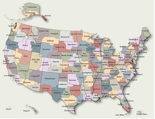
To Select Another NWS Office Click on Map or Choose from List

County Warning Area MAP
Select Forecast Office:   Select Product:  
286
FLUS45 KBOU 141044
HWOBOU

Hazardous Weather Outlook
National Weather Service Denver/Boulder CO
444 AM MDT Sat Mar 14 2026

COZ030>051-151045-
Jackson County Below 9000 Feet-
West Jackson and West Grand Counties Above 9000 Feet-
Grand and Summit Counties Below 9000 Feet-
South and East Jackson/Larimer/North and Northeast Grand/
Northwest Boulder Counties Above 9000 Feet-
South and Southeast Grand/West Central and Southwest Boulder/
Gilpin/Clear Creek/Summit/North and West Park Counties Above
9000 Feet-Larimer and Boulder Counties Between 6000 and 9000 Feet-
Jefferson and West Douglas Counties Above 6000 Feet/Gilpin/Clear
Creek/Northeast Park Counties Below 9000 Feet-
Central and Southeast Park County-
Larimer County Below 6000 Feet/Northwest Weld County-
Boulder And Jefferson Counties Below 6000 Feet/West Broomfield
County-
North Douglas County Below 6000 Feet/Denver/West Adams and
Arapahoe Counties/East Broomfield County-
Elbert/Central and East Douglas Counties Above 6000 Feet-
Northeast Weld County-Central and South Weld County-Morgan County-
Central and East Adams and Arapahoe Counties-
North and Northeast Elbert County Below 6000 Feet/North Lincoln
County-
Southeast Elbert County Below 6000 Feet/South Lincoln County-
Logan County-Washington County-Sedgwick County-Phillips County-
444 AM MDT Sat Mar 14 2026

...RED FLAG WARNING IN EFFECT FROM 11 AM TO 9 PM MDT TODAY...
...HIGH WIND WATCH IN EFFECT FROM LATE THIS EVENING THROUGH
SUNDAY AFTERNOON...

This hazardous weather outlook is for northeast and north central
Colorado.

.DAY ONE...Today and Tonight

Critical fire conditions will be in place today across all of the
plains and Palmer Divide.  West winds will gust from 40 to 60 mph
with humidity levels below 10 percent.  Some gusts up to 70 mph
may occur in and near the foothills this afternoon.

Tonight, a strong cold front will move across the plains overnight
with wind gusts from 50 to 65 mph behind the front.  In addition
some light snow may fall as well over the plains. In the mountains
there will be a period of snow with hazardous travel expected
overnight due to blowing snow.

.DAYS TWO THROUGH SEVEN...Sunday through Friday

Strong winds will continue across the plains on Sunday with gusts
from 50 to 65 mph possible.

A quick warmup and a high potential for record warmth can be
expected by mid week.

.SPOTTER INFORMATION STATEMENT...

Spotter activation will not be needed, but any reports of high
wind will be appreciated.

$$

Previous Hazardous Weather Outlooks may be found at
NWS Denver/Boulder, CO (BOU) Office Hazardous Weather Outlooks.
(Click 'Previous Version' there to view past versions successively.
Some may differ only in time posted.)

San Juan, PRHonolulu, HI Lake Charles, LA Pueblo, CO Corpus Christi, TX St. Louis, MO Reno, NV Raleigh, NC  Newport/Morehead City, NC Dodge City, KS Houston/Galveston, TX San Joaquin Valley/Hanford, CA Louisville, KY Fort Worth, TX Pittsburgh, PA Austin/San Antonio, TX Sacramento, CA Jackson, MS Phoenix, AZ Northern Indiana, IN Flagstaff, AZ Tallahassee, FL Springfield, MO Riverton, WY Blacksburg, VA Sioux Falls, SD El Paso Area, NM Columbia, SC Wilmington, NC Greenville-Spartanburg, SC Eureka, CA Midland/Odessa, TX Tucson, AZ Goodland, KS Huntsville, AL Amarillo, TX Norman, OK Lubbock, TX Marquette, MI Little Rock, AR Pendleton, OR Missoula, MT Binghamton, NY Boston, MA Green Bay, WI Billings, MT Baltimore/Washington San Diego, CA Tampa Bay, FL Morristown, TN Twin Cities, MN Brownsville, TX Portland, OR Des Moines, IA Memphis, TN Pocatello, ID San Angelo, TX Jacksonville, FL Aberdeen, SD Quad Cities, IA/IL Charleston, SC New Orleans/Baton Rouge, LA Peachtree City, GA Shreveport, LA Grand Rapids, MI Medford, OR Albany, NY Wichita, KS Gray/Portland, ME Spokane, WA Boise, ID Denver/Boulder, CO Great Falls, MT Caribou, ME Key West, FL Miami-South Florida, FL New York City/Upton, NY Melbourne, FL Hastings, NE Paducah, KY Glasgow, MT Bismarck, ND Charleston WV Omaha/Valley, NE Buffalo, NY Jackson, KY Kansas City/Pleasant Hill, MO Gaylord, MI Cheyenne, WY Grand Forks, ND Detroit/Pontiac, MI Central Illinois, IL Burlington, VT Salt Lake City, UT Topeka, KS Nashville, TN Milwaukee/Sullivan, WI Albuquerque, NM Las Vegas, NV Wakefield, VA La Crosse, WI Birmingham, AL Los Angeles/Oxnard, CA Chicago, IL Seattle, WA Rapid City, SD Indianapolis, IN Philadelphia/Mount Holly, PA Mobile/Pensacola State College, PA Cleveland, OH Elko, NV Wilmington, OH Grand Junction, CO North Platte, NE Tulsa, OK San Francisco/Monterey Bay Area, CA Duluth, MN Anchorage, AK Fairbanks, AK Juneau, AK Tiyan, GU

Products Courtesy of NOAA-NWS
NWS Information Parsing Script by Ken True at Saratoga Weather - WFO and Products Scripts by SE Lincoln Weather.
Mapping by Curly at Michiana Weather and by Tom at My Mishawaka Weather.